Thursday, October 23, 2014

Jerome State Historic Park

Jerome State Historic Park is located in the once copper rich hills of Jerome, Arizona. Jerome is at an elevation of 5,246 feet.
Growing up in the midwest a person is use to seeing Dandelions taking advantage of every crack and crevice to take root.  In the southwest it's cacti!
The following pictures are taken from the hilltop where the mining baron James S. Douglas built his mansion and what is now the park's visitor center and museum. This view looks down to the old Clarkdale Smelter closed in 1953. The community of Clarkdale is to the right. It was a company town founded in 1912 by William A. Clark for the Clarkdale Smelter workers and is said to be one of the first planned communities in Arizona. William Clark had one of the largest producing copper mines in the Arizona Territory! It was called The United Verde Copper Company. 
This is Jerome as you come up the hill into town. From the early 1900s through the 1920s there was a building boom. The town's population reached it peaked in 1929 at approximately 15,000!!! After the United Verde Mine closed, the population of Jerome dropped to 100! The population today is reported to be 444. There are many historic buildings still present and the old downtown is filled with gift shops. The hill with the J on it is called Cleopatra Hill. 
This is further into town as you wind up the hill to the Douglas Mansion and state park. The cuts you see in the hillside to the back of the picture is the United Verde Mine, which ran from 1882-1953.
This is the original James S. Douglas mansion. It was built in 1916 on the hill above his Little Daisy Mine. The Little Daisy Mine was purchased in 1912 and operated until 1938.
Check out the rocks inlaid into the cement curb. I don't know if that is a modern feature or original, but it is very attractive!
This large chunk of ore sits by the front doorway. The blue is Azurite, which is one of the two basic copper (II) carbonate minerals. The other is Malachite which is a bright green. Both were used as paint pigments. The blue of the Azurite is so intense that it seems like it can't be natural!
This is a peek into the mansion! This room is the park's visitor center and the other rooms of the house are set up with museum displays.
Mining equipment is set up around the outside of the Douglas Mansion. Pneumatic drills came into use in the 1870s. While more efficient than earlier systems, these drills became known as widowmakers, because of the silica dust they created! Breathing in the razor-like debris was responsible for a condition known as miner's consumption. Hundreds of miners died from this occupational hazard until water flushed drills were introduced in the 1890s.  
This is a stamp mill and is used for crushing rock.
This is called a jaw crusher. It was the primary crusher and was generally followed by other crushers chosen for how fast they could feed the rock through and how fine the crush was.
Mining transport!
This is the miner's transport into the mine where they would work 8-12 hour shifts!
The large square building in the background was once the Little Daisy Hotel and was built to house the miners who worked the Little Daisy mine. It is now owned as a private residence! The large building on the street curve is the Mine Engineering Building. The two headframe structures are over two separate Little Daisy Mine shafts. The rock cut to the back of the picture is the United Verde Mine. Jerome is a fascinating look into mining history!   

Thursday, October 16, 2014

Montezuma's Well

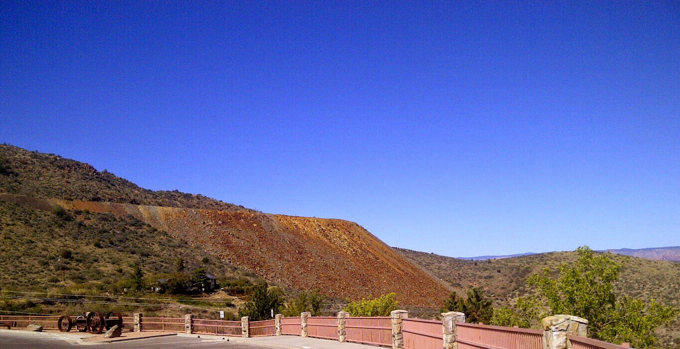
The locations of Montezuma's Castle and Montezuma's Well are close enough that both can be done in the same day, but we recommend doing them on different days so that things to be seen aren't hurried past or skipped all together.  We did them both on the same day and had to make a return trip to Montezuma's Well to do it right! 
Montezuma's Well is a naturally occurring spring in the desert.  Even in times of regional drought, about 1.6 million gallons of water flow through two main vents at the well's bottom each day.  The flow is fairly regular and the temperature is a nearly constant 74 degrees. Diving explorations have determined that there are no fish in the water, but thousands of freshwater leeches! The good news is that the leeches are not the blood sucking type, but a leech specific to the well that eats amphipods! At 55 feet divers report that fine sand boils up in swirling cascading mounds creating a false bottom. The vents are another 65 feet down!  Without fish, the well does not have typical lake dynamics. Carbon Dioxide 80 times higher than most lakes makes life impossible for fish, amphibians, and some aquatic insects. The well is the world's only home for five species, including a miniature shrimp-looking amphipod, a leech, a tiny snail, a water scorpion, and a type of one celled plant called a diatom.  The pond weeds have stems up to 25 feet long making them among the tallest aquatic plants in the world!      
Across the pond in the cliff face you can see pueblos. These were built by the Sinagua Indians during the same time period as Montezuma's Castle, 1100-1400 AD.  The well is a sacred location for the Zuni, Hopi, and Yavapai Indians whose origins are linked with the Sinagua Indians that lived here.    
The dwelling walls haven't been rebuilt, but only patched in place as needed.  Multiple room dwellings were also located on the upper rim of the well.
Be sure to take the steps down to pond level, as there are more pueblos and the water's exit way from the well!
This is an interesting pueblo.  Through the doorway and to the back of the room is a rough opening that appears to enter further into a cave.  You can see a similar opening to the back of the pueblo that would have been on the right!
When Roy and I see these rectangular pueblo foundations, we can't help but compare them to the efficiency and comfort we find in our little 24' camper and think how practical and comfortable the pueblos must have been for the people of that time period.
Here is a pretty dragon or damsel fly.  It was quite tiny.
Here's some of nature's artwork!
Isn't the late day reflection in the water pretty!
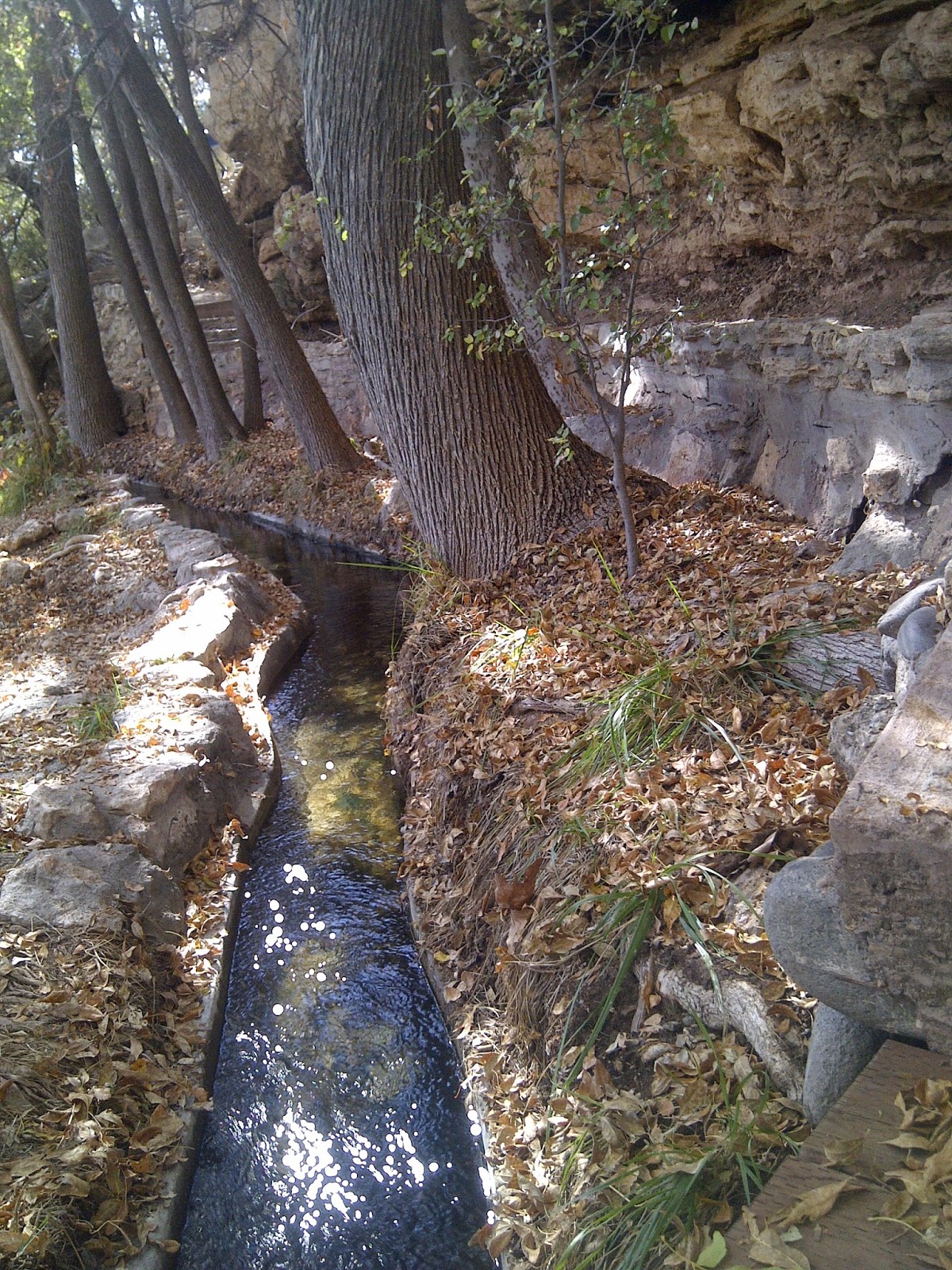
On our return trip to Montezuma's Well we had the energy to explore the ancient irrigation system the natives created over 1,000 years ago!  These steps down from the well's rim take you to the location where the well water exits from a natural 150' long underground passageway and reappears above Wet Beaver Creek.
The area below the hilltop is beautiful and serene!  It is said to stay about 20 degrees cooler than on top.  The irrigation ditch is known to have run about 7 miles and is over 1,000 years old.  It has been given some modern edge reinforcement to help preserve it.
This is the ditch as it proceeds downhill from higher up and closer to the rock hillside.  The water in the well and irrigation ditch is said to be high in arsenic content and may have caused ill health if the people drank from it rather than from Wet Beaver Creek that it pours into.  
The irrigation ditch is still used today by the community of Rimrock to water their fields and livestock!  It appears that as this tainted water mixes with the creek water it must become acceptable for use!
Isn't this pretty with the long roots flowing in the water and the foliage growing in the rock crevices!
On the far right is the crevice where the well water resurfaces from its underground passageway through the hillside and is then captured by the irrigation ditch! Without the irrigation ditch, the well water would run directly downhill into Wet Beaver Creek.   


Tuesday, October 14, 2014

Montezuma's Castle

Montezuma's Castle is amazing! There is a pleasant 1/3 mile loop in the valley below it where you can walk and gaze at its beauty from afar.  Access into the castle ended in 1951 to help preserve it.
The southern Sinagua natives built this five story, 20 room dwelling sometime between 1100 and 1300.  By 1425 the inhabitants had abandoned the dwelling. When European-Americans first observed the ruins in the 1860s they named them for the famous Aztec emperor Montezuma in the mistaken belief that he had been connected to their construction.  In fact, the dwelling was abandoned more than 40 years before Montezuma was born!  The structure was not a castle either in the traditional sense, but instead functioned more like a prehistoric high rise apartment complex!
The castle sits 100 feet above the valley. Most of this structure is original.  Note all the openings in the cliff face below the main castle that would have also been dwellings!!!
The castle actually looks like it would be a fairly easy walk from the valley to the base of the cliff.
Next to Montezuma's Castle in the cliff face are lots of holes. I wasn't sure what we were looking at until later reading this informational sign.  It states that at one time another castle existed against the cliff face.  It was only referred to as Castle A.  Castle A was five stories high and had about 45 rooms!  I learned that the trick to counting the number of stories is to sight in on the small beam holes that would have been the roofs between stories.
This picture shows four stories starting with the stacked rock structures on the valley floor.  Two stories were built into the large L-shaped opening.  Watch for the beam holes and compare against the previous picture for your accuracy in counting the levels. 
This shows all five stories.  The recesses in the limestone cliff face start out as natural erosion from wind and water and then are enhanced by the people establishing dwellings.  Some literature stated that the man enhanced tunnels are called cavates and are all very similar.  They tend to be 10 feet deep.
One more look from the far side of the loop.  It is sooooo beautiful and hard to leave.
This is an Internet picture from on top the castle.  Isn't the valley below gorgeous!  The waterway is Beaver Creek which flows into the Verde River.  This community was estimated to have a population between 150-200 inhabitants. By 1200, communities extended all along the Verde River and its tributaries, which had floodplains for cultivating crops.  These waterways were travel corridors, connecting an estimated 6,000 people in the valley to large populations to the northeast and south. Around 1300 the Verde Valley had at least 40 large villages of which the Montezuma's Well dwellings and Tuzigoot pueblo were part.  More on those later!
Recently we were out exploring the area and ended up down on the Verde River in an area called Beasley Flats. Check out the dwellings all along the cliff face! Sooooooo amazing!!!  

Saturday, October 11, 2014

Fort Verde Days Parade

We enjoyed being in Camp Verde during the October 11th and 12th annual Fort Verde Days celebration.  The weekend's festivities got underway with a great hometown parade! 
Here come the color guard!
More beautiful horses!
Smokey!
The kids in the parade all seemed extra cute!
One of the weekend events was a vintage baseball game.  Isn't it cute the way the one fellow posed!
What's a parade without fire trucks and police cars! What Roy and I loved most is that they didn't blast their sirens and horns like most parades we've gone to!
There is a local Greyhound rescue group.  These are retired dogs from racetracks.  You would think having a Greyhound as a pet would require providing lots of exercise for them, but I've heard from people involved in their rescue that the dogs are very calm and actually make good apartment pets!
Here is a picture showing the motorcycles heading east out of the new section of Camp Verde toward the old downtown.
I love the Chino Valley High School Marching Cougars uniforms! They sounded great, too!
Here's the cougar!!!  I'm glad it posed for a picture!
Here's a nice float with some more of the cute kids!
I haven't ever seen this done in a parade!  Great idea!
There were some vintage cars and trucks!
I'm not sure if it's a tractor or a bulldozer, but it looks like it'll get the job done!  I loved seeing an outdoorsy farm girl driving it!
This was an interesting invention!  The passenger in the 4 Wheeler was controlling the gadget the girls are riding on.  He could make it go in circles or slither like a snake!  It moved right along!
Here are representatives of the Yavapai (Yuh Vuh Pie) Apache Nation.  There is a local reservation. Camp Verde is in Yavapai County.
The End!  This is looking past the strip mall toward the r.v. park. Love this sweet community!